There is a pleasure in the pathless woods,There is a rapture on the lonely shore,There is society, where none intrudes,By the deep sea, and music in its roar. I love not man the less, but Nature more. -Lord Byron

Thursday, January 30, 2014

Ramona Falls...kind of

http://www.portlandhikersfieldguide.org/wiki/Ramona_Falls_Hike

We walked in the general direction of Ramona Falls for a while, but were thwarted by the Sandy River crossing. The bridge was out for the season, as it was early December, but we thought we may be able to cross using on of the many log jams. We decided this was too dangerous when we saw that most of the logs had 4" of ice on them. Would have been fine with just two-legged hikers, but wasn't worth it for woodsmen of the 4-legged variety. We will definitely get back in the spring!


Tim and the hounds. Much of the first portion of the hike is along the glacier-scoured Sandy River. This damage occurred during the 2006 glacial outburst. Amazing how powerful nature can be.

Virg and Maggie in the debris field. See all the ice on that log?


Ramona is another hole in my hiking resume. As soon as the dogs can join, we'll head back up there, although it was nice being the only one on the trail!

Trillium Lake

We took a quick trip out to Trillium Lake around Thanksgiving, so we could get a loop in before they closed the access road. The road was real icy, but we were able to get in/out with no real problems. We lucked out on a real nice day, so we took the opportunity to take some photos for our xmas cards. Great day! We did the one mile loop around, which I've never actually done. Here's a few I-Phone shots. (Speaking of which, the resolution of these Iphone photos looks terrible on the web...will start lugging SLR around)

South side of Trillium:


Saturday, January 25, 2014

ANGELS REST: Popular for Good Reason

http://www.portlandhikersfieldguide.org/wiki/Angels_rest

Angels Rest is a very popular hiking destination for Northwest natives, as well as tourists, it is along a belt of well traveled hikes along the south side of the gorge, along the Historic Columbia River Highway. The hike itself is 4.8 miles round trip, and the spectacular views at the top are what makes it so well loved, it is quite breathtaking, even on a foggy day, it's heavenly, and you should definitely see it for yourself!

A heads up for hikers with canines, the trail is dog friendly (though there is a sign to leash your dogs at the trailhead). However, depending on how "cliff friendly" your dog is, you may want to leash them at the top because there are cliff sides and drop offs that would most definitely be a fatal fall for humans and dogs. Maggie will jump off anything for the right sized pica or bird, so we leash her at the top! Bring the kids and the whole family on this hike, it's by no means difficult, and you won't regret it!

Taken from Portland Hikers Field Guide :"If you want a longer hike, you may visit Devil's Rest, a forested summit about 850 feet above Angel's Rest (just head up on the main trail away from the river, and keep right at the junction at 0.2 miles). Although there are no views at Devil's Rest, it is a pleasant forest walk - and an added exercise. Or you may do even longer Angel's Rest-Devil's Rest Loop Hike and visit a couple of great viewpoints just off-trail east of Devil's Rest."

View looking westbound not quite to the top

This area is running wild with picas!

My Maggles


Friday, January 24, 2014

Jefferson Park Via South Breitenbush Trailhead

http://www.portlandhikersfieldguide.org/wiki/Jefferson_Park

Wow. Jefferson Park is unbelievable. My friend Dale and I did this as an overnighter. The hounds stayed at home because it would be a little much for them. If you want a truly incredible backpacking experience, I could not recommend Jefferson Park highly enough.

There are several ways to reach Jefferson Park. Click the PHFG link above for the details on that. No need to go over it here. I'm not sure why we picked this particular trailhead, as it is considered to be the least scenic and most difficult approach. The hike was fairly difficult, but was quite lovely in my opinion. I'll will hopefully be making this an annual destination, so I'll try other approaches in the future, so that I can compare and find my favorite.

The bottom portion of the trail goes through some thick forest, but quickly changes to sub-alpine meadows about halfway through. Using this approach, you get glimpses of Jefferson over the ridge every now an then. The meadows must be great when the wildflowers are in bloom. They were absolutely covered in ripe blueberries when I visited on an unseasonably warm mid-September day.


This shot was taken just as we descended down into Jefferson Park itself. Pictures don't do this place justice (especially Iphone photos). It is one of the most beautiful places I have ever been, and I was already planning my next trip before I even set up my tent!


Here you'll find the Poler one-man tent in the wild, where it belongs.


There are five lakes in Jefferson Park. We stayed on the open shore of Scout Lake. It was a super clear night and we were able to view several shooting stars. The next morning after breakfast we went for a swim in Bay's Lake. This is the most scenic lake, in my opinion. It's deep, clear, and super refreshing on a hot day.  


This is a must-do Oregon hike.


Oneonta Gorge

http://www.portlandhikersfieldguide.org/wiki/Oneonta_Gorge_Hike

The Gorge has such a wealth of hiking/backpacking opportunities, that I often skip the more popular trails/destination thinking that they will be too crowded. One of the great advantages of having weekday availability, is being able to experience awesome places such as Lower Oneonta Falls while most everybody else is at work. This might be my new favorite swimming hole in Oregon.


The "hike" is a 1 mile there-and-back, but it is rated as difficult for two reasons. Here is the first:

  
There is a large log jam at the beginning of the trail that you have to scramble over. I wouldn't recommend this for dogs or people who aren't so sure on their feet. I've heard the logs can be unstable at times, so definitely exercise caution here.
 
The second reason is this:
 
  
The hike isn't really on a trail at all, but rather one must follow a shallow-ish stream all the way to the falls. The stream is in a gorge, so there is no way to avoid getting wet. The deepest part in mid summer will about chest deep on an average-sized adult. If it's a hot day it will feel great, and the payoff is worth it.
 
The hike ends .5 miles from the log jam at Lower Oneonta Falls, seen here. The water gets much deeper here, so you can swim right up to the falls if you like. It's amazingly beautiful and a great way to spend a weekday afternoon.


Golf Camp!

Virginia sat out a few adventures that I (Tim) took either solo or with others, so the next few posts will be Virginia-less and dogless (Chloe the Basset is limited, so if the hike is difficult/long, she has to stay home, where she can lounge and bark and fart to her heart's content.)

My east coast buddy and I took a week long golf/camp trip across Oregon. We didn't get a whole lot of hiking in, but got to see a lot of this  beautiful state...such as:

Swimming in the Mckenzie River! This was the first week of August and it was absolutely freezing. We camped up The Aufderheide, and made our way to Terwilliger Hot Springs in the AM.


Golfing in rad places! This is my favorite course in Oregon. It's called Buffalo Peak and is located in Union, OR. I would highly recommend the Union Bagel Shop on E. Electric St. Best bagels I've had on the west coast. If ya don't know, now ya know.


Painted Hills! This might sound dumb, but I've driven through Mitchell, OR about a half dozen times and couldn't find the painted hills. But, I succeeded this time.


More golf! This is from the South Fork Golf Course which you need to go to to truly appreciate it. It has an honor box out front, a weird layout, and it's a hidden gem. If you want a manicured, cater-to-your-every-need golf course, don't stop here. If you want to drink a Bud and get to know the owner who built his own golf course in the vein of Field of Dreams, this is your spot. Par 3, by the way.
 
 
One of the hikes that we did do was Strawberry Lake from Strawberry Campground. It's a short 2.6 mile there and back that is totally worth your while if you happen to be staying at the campground. Even better, park at Strawberry Campground and hike up and set up shop right on the lake. The lake sits at about 6,200 ft, so it can get a bit chilly at night, and fires are generally prohibited in the Strawberry Mountain Wilderness all dry season, so bundle up. Also, the FS 6001 road is pretty slow going, but it passed the 2007 Ford Focus test.


I definitely will be back to this area to do some exploring. Golf Camp 2013 was rad, and I hope it will become a tradition. 


Monday, January 20, 2014

GILLETTE LAKE: Pacific Crest Trail-section H

I've done this hike several times, the lake itself is a great spot for backpacker's looking for a nice camp spot, and there are several other well marked camp sites up the creek within 50 yards from the lake. It's a perfect in and out day hike as well, and since you are on the Pacific Crest Trail you can pretty much turn around whenever you feel like it. Depending on which access point you use,  you will hit a fairly moderate elevation gain, and more involved techical hiking (depending on the weather)  about 8 miles in as you are climbing up Table Mountain. If you are up for it, it is well worth the views.

The lake itself is only 2.9 miles in from the Bonneville Trailhead parking lot. The alternative starting point, (used mostly by PCT through-hikers) is just west of the the northend of the Bridge of the Gods. I usually park my car in the parking lot at the northend of the bridge, where the local honey farmers sell their goods. I can't confirm that this is "allowed" per say, but there are no "no parking" notices, and I've never had a problem. From there you walk to the trailhead, and the lake is about 4 miles in.

Regardless of which entry point you decide on, the hike itself is pretty simple, very family and dog friendly.  You lose the sound of the freeway sooner than you would think as most of the hike is heavy forest, (which makes it nice and cool in the summer months). The only issues we had on our summer overnight trips to the lake were the clear cut sections in direct sun, where the dogs got overheated pretty quickly. Chloe (the bassett) decided she was done walking for the day by sitting down in the middle of the trail and refusing to move when we were about 100 yards from the lake--loud and clear Chloe! She got a free fireman carry the rest of the way. We learned our lesson that maybe we need to take a little break before the clearcut sections to let everyone catch their breath and pound some water!

There is a wonderful campsite on the lake, with a huge fire pit, and a little private trail, you feel very secluded, and it's one of my favorite places to camp in the Gifford Pinchot. Others don't find it so "secluded and lovely", because of the view of powerlines and logging roads on the south side of the lake. Granted, it's not the most breathtaking view, but at least you are looking at all points of entry on the lake, which gives you a sense of security.

The lake is absolutely freezing, most of the time, but still worth a dip, and if you are savvy, a rod for the golden trout.

Several years ago, while doing the hike with 5 other PCT hikers, we saw the very large back end of a bear, approximately 2 miles in from the Bridge of the Gods access point. It was very exciting!

Here's the PHFG's page, for directions and more details http://www.portlandhikersfieldguide.org/wiki/Gillette_Lake_Hike
At the Bonneville Trailhead Access, leave your car empty and unlocked! Lots of break ins in this parking lot day and night!

Looking south during the last clearcut section before the descent to the lake

Best fire pit ever

View of the moraine while heading down to the lake

Tim exploring the different uses of the backcountry "Buff"

Heading back up the next morning

Notice the powerlines, this picture is taken from the logging road before you start the trail down to the lake.

That dang floatee never disappoints.

PCT markers on the trail.


Sunday, January 19, 2014

CRYSTAL CRANE HOT SPRINGS: aka, my favorite place in Oregon.

http://cranehotsprings.com/
59315 Hwy 78
Burns, Oregon 97720


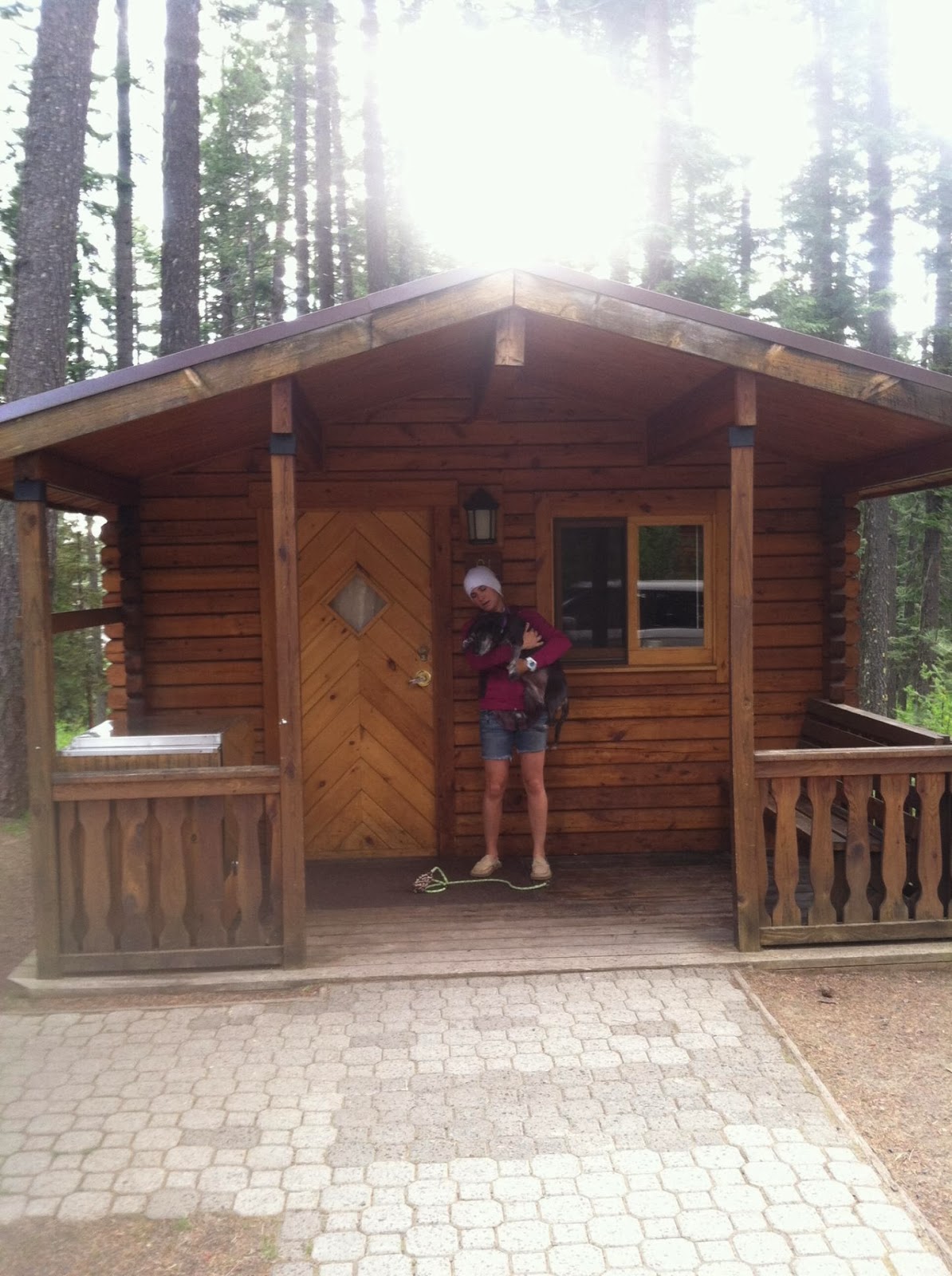
 We try our best to get out here at least twice a year. It's a magical place and has affordable dog friendly cabins right on the hot spring pond ($52-$67 a night with $7.00 dog fee). There is also a large teepee with an optional private tub for $55 a night! Back to the watering hole, it's a hot spring the size of a pond, it's open 24 hours, and you can sneak out any time during the night and float around on your back, getting lost in the infinate stars. It's the closest thing to an out of body experience I think I'll ever have. You truly feel like you are weightless and drifting through the universe. The spring is not quite as hot as some may like it, but you can sit close to the outpour, where it is up there as hot as the rest. Otherwise it is usually somewhere in the department of 98-104 degrees.  If there are too many people in the pond, and you want some privacy, you can rent one of the private soaking tub rooms, complete with candles and towels for $7.50/hour for adults, and  $4.00/hour for children 6 and under.

There is a small shared kitchen on the property, with a dinette, microwave, stove, and shared fridge. There is also a lovely air conditioned and heated commons room with a large fireplace, books, board games, and fresh coffee every day.

You will most likely run in to traveling retirees here, as this is a hot spot for rv'ers on the road. Other then that it seems like a well hidden secret, and a good spot to decompress. There is free wifi for guests, but no televisions or radios in the cabins, feel free to leave your gadgets at home, but bring the gazateer because this is definitely not on a well traveled road!

Your closest "other" amenities are in the town of Burns, OR. There is a Safeway, a friendly family owned mexican restaurant, and our favorite, "The Broadway  Deli". This place has it all, and the sweet and friendly owner/chef/barista is lovely to chat with, and makes the best home made ALL OF THE ABOVE. Plus she caters to vegaterians, etc. You name it, she'll make it. Which is often hard to find in small towns! She also owns the women's clothing consignment shop that's connected to the bakery which is fun to poke around while she's whipping up your grub.

Depending on where you are coming from, the road trip to Crystal Crane can be a beaut. There are several small ghost towns, eateries, breweries, and geographical wonders to visit throughout central and eastern Oregon. On this particular trip, we took Interstate 84 eastbound from Portland to Pendleton to visit the woolen mills. Then stayed a night at Emmigrant Springs State Heritage Area, just west of Pendleton, where you can get a dog friendly cabin for $47. Equipped with space heater, a bunk bed, twin bed, outdoor grill, covered front porch, covered grill, and short lighted walk to the well kept bathrooms/showers. I really liked this place, even with it being so close to the freeway, it was plenty quiet at night! I have a feeling it is busier when they have large group reservations, as there is a community hall, and group camp areas. I picture hundreds of girl scouts, or kids making out in church camp.

We then continued westbound 84 and up 82 towards the towns of Joseph and Enterprise Oregon. I've always wanted to go to Josepth because I've heard they have beautiful turqoise! Plus you get to visit Wallowa Lake which is just too pretty to even describe! From there we drove up the long winding road to Hells Canyon. If you make it to Joseph, go to Hells Canyon, bring your emergency kit, this would be a bummer of a place to break down without your supplies! We meandered our way back down to Burns with a few detours, sevaral wind and lightning storms, and a few stops at broken down houses, and the now and then thrift shop in a constant search for bones!


Yukon and his friend, the pygmy horned toad, grumpy faces.


Fatty Magoo, he's so handsome! Didn't find any bones off the side of the road, but this was even better!


Lighting on HWY 78, about a mile from the springs

My most favoritest place!

That's my head in the water, just southeast of the sun!

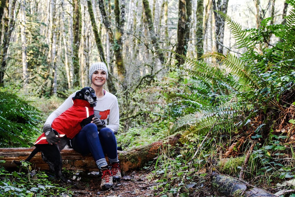
The one and only Chloe Breault

Demonstrating the wonder of the Poler Napsack at Hells Canyon

Wallowa Lake, heavy construction on the eastside of the lake, but still some campsites open, and you can rent canoes or paddle boats, and fish right off the dock, if you're in to that kind of thing.
Great little dog friendly cabins at Emigrant Springs Heritage Area


So much history, so many picas, so many gophers, Maggie is going to lose her mind!


This sign is my favorite. Thumbs up Joseph, OR!

We went back for a Crystal Crane visit when Tim's Mom Pauline came to visit in February this year (2014).  The girls sure loved having someone to cuddle up with in the back seat!

Stopped in Deschutes County about 40 miles outside of Molalla, OR. Saw a Rocky Mountain Goat from this lookout point.


Perfect weather for 100 degree hot spring.

Team handstands in the pond!
 

Saturday, January 18, 2014

SODA PEAKS LAKE TRAIL #133

Visit the Portland Hiker's Field Guide link for best directions to this Trailhead http://www.portlandhikersfieldguide.org/wiki/Soda_Peaks_Lake_West_Hike

Distance: 4.4 miles
Elevation gain: 1270 feet
High Point: 4780 feet

Free, sign in at trailhead, no pass required "self issued wilderness permit"

We took the west trail in to Soda Peaks Lake, it is the shorter option, and you most likely won't have to worry about the bridge being out, or trail damage/blockage.

This hike is best in the summer and early fall, otherwise you will be in and around snow. Our vehicle was swarmed by a murder of horse flies as we pulled up to the trailhead, at first we thought we had driven over a hornets next, as they were literally attacking the car. Don't let them scare you away, just grab your gear and run 20 feet! They didn't follow us, they were just pissed at the car. I would empty your car of everything before you head up the trail, and leave the doors unlocked, when you park on those forest roads, you never know who will want to look through your car, and its better to avoid having broken glass.   We saw a lot of scat on the trail, some cougar, some possibly cayote.

The hike is listed as "moderate" difficulty on the Portland Hiker's Field Guide website, but in my personal opinion, it's more like moderately difficult, especially with a 30-40 pound pack, you climb straight up and straight down to the gorgeous lake, with 360 views of the moraine and thick forest towering over you. The first campsite you will come to is the largest with the best access to the lake, nice fire pit as well, however there is a "no camping" sign posted specifically in this spot, so chose your own adventure on that. There are a number of good campsites at the lake, which lies nestled in a glacial cirque below the summit of an old volcano that erupted about 360,000 years ago.

Tim was a little bummed he did not have a fishing pole with him, and made use of my emergency fishing lure and an unfortunate beatle. He got several bites, but no dinner. The weather was perfect and sunny with spots of shade, followed by the largest wind/rain storm I have ever witnessed in a tent. Very very large branches were falling throughout the night all around our tent, so maybe it would be best to keep the tent in a clearing if you feel a storm coming in.  All in all, a short distance challenging hike, with one or two breathtaking views, and a gorgeous, relaxing destination. (As well as a possible visit from Sasquatch, I've never smelled anything like that in my entire life, enough to make me closer to a believer) We will be back.
After the first climb, a viewpoint of Gifford Pinchot forests

Maggles the super dog

The best 2 dollar camp purchase ever, floatee and outdoor bed, weighs next to nothing

Dang trees get out the way!

Here fishy fishy
We decided to take our chances and camp at the first main camp site, since it has such a nice access to the lake, not sure why it has the "no camping" marker. We figured the chances of a ranger coming down and booting us out to a different spot were small, but all the other sites were empty as well, so that wouldn't have been a problem.

Yukon and Chloe at the crest

Trailhead, safe distance from the flies.

Friday, January 17, 2014

ALDER FLATS: Magical Swimming and Secret Frogs

Alder Flats Trail and Campground directions:
Travel SE on Highway 224, just 1/8 mile prior to reaching the Ripplebrook Ranger Station. On the right hand side of the road, you will see Alder Flats trail head #574. Easy hike, 1.8 miles in and back. .9 miles down to the campground (6 sites and room for more if they are full) and the river. May want to leave the grill at home and bring hiking backpacks to make carrying your gear down less of a shit show. No bathrooms or facilities at the campgrounds, and pack in/out your trash, bring a hefty garbage bag, you'll be glad you did. Usually no fee to camp/park but that can change depending on time of year. This secret spot has been leaked on local news sites and papers in the last few years and you now have a frequent occurrence of fraternity like campers that leave their rubbish everywhere (even on skull island), and have a general douche-ness about them, hopefully they'll get tired of packing their gear down and the fad will fade, so those who truly appreciate this place can keep coming for its awesome swimming hole and adorable frogs.


My hotmail was not so hot and got hacked. So my old blog virginiakrakowiak.blogspot.com is no more, and will be from here forth a permenent fixture and acount of my late 20s and early 30s. This new blog is more of a journal, a sordid online diary, accumulation of field notes, and subjective view on the infinate hikes and destinations in the Pacific Northwest, as well as the every so often road trip to the somewhere further. We like to be outside, we like to spend time with our dogs, and we strive to be nice to the Earth, it's the little things that count, we are blessed to play and have food to eat, a warm place to sleep, and dogs to cuddle.

Here is our Christmas photo from 2013. Taken at Trillium Lake, Mt Hood.