There is a pleasure in the pathless woods,There is a rapture on the lonely shore,There is society, where none intrudes,By the deep sea, and music in its roar. I love not man the less, but Nature more. -Lord Byron

Sunday, April 6, 2014

WAHKEENA FALLS: Columbia River Gorge

Wahkeena Falls Hike directions and information from Portland Hikers Field Guide: 

Easy, short, family friendly, dog friendly hike. If you live in Portland and have family in town, and you want to take them outside, but not everyone is in the best shape, or young and spry, this is the place to go! It is very easy, quite pretty, and you don't even need to pack a lunch (but still bring water and energy inducing snacks just in case because its the smart thing to do!)


BAKER RIVER TRAIL: North Cascades Wilderness and North Cascades National Park

Click the link for Washington Trails Association web page with directions and details on this knock-out hike:

Glacier, WA in February for "snowboarding and golf vacation". Well, actually I was on a "hang out with the dogs, read books, eat food, and hike" vacation. Either way, it was lovely. We drove several hours from Glacier to check out the Baker River Trail hike. Again, we picked this out of a Northern Cascades Wilderness hike book from our local library. It's great to have the book with you when you are on the trail, in case you get turned around, or arrive at a closed trail and have to pick something else, etc.

This entire trail was filled with ancient cedars, and petrified logs. Don't be fooled by the sunshine, as it was quite cold out! A good portion of the rock areas on the trail were frozen over.  The trail was in beautiful condition considering the warnings we saw in our books stating the several areas that were damaged or washed out from the large flood in 2006.  We did not see any other hikers, but you can tell the trail has been cared for and well maintained throughout the season. It seems as though this trail could be treaterous depending on the weather deep in to winter. Had there been snow, we may not have been able to have the same access.

There are a few areas where you have to cross a small creek, make sure you have ways of staying dry. A few miles in you will come to the boundary for the North Cascades National Park (dogs not allowed past this point). If you continue past, in half a mile you will come to an epic camp site just south of Sulphide Creek, where if water is low you can walk out to an unbelievable view of Mount Shuksan (pictured below). This is a great spot to set up shop for lunch.  If you head back at this point, you'll make it a 5 mile in and back hike.

This is serious business folks.
Maggie trying to follow my lead in manuevering the icy trail.
Frozen steps, all over the trail. Quite pretty, and oh so slippery!

Tom crossing some very cold water!

So many huge ancient cedars on this hike, what a treat.

"I'm goin' where the sun keeps shinin', through the pourin rain...."
Insect Art

Timmy and Tommy at the National Park Border (No dogs allowed past here)
Knockout View of Mt. Shuksan. She's a beaut Clark!
Great little camp spot close to the river. Again, no dogs allowed here, it's National Park land.

It was quite a breathtaking hike.

(below) Someone's been busy!

MIRROR LAKE

Click the Portland Hikers Field Guide link to get directions and the details. 
  
Mirror lake is a quick and easy hike to a breathtaking lake with a spectacular view of Mt. Hood. You've no doubt seen this image in postcards, calendars, or promotional ads about Oregon and its many wonders. It is 2.9 miles round trip, easy hike, and family and dog friendly. They close the hike when the snow hits late fall, but it is open to snowshoers.

You can continue past the lake to access the Tom Dick and Harry Mountain hike, which is a 5.8 mile round trip with knock-out views as well.


DRY CREEK FALLS

Portland Hikers Field Guide link to the hike:

Dry Creek Falls is a great back-up hike for Portlanders. When you don't want to drive too far, or you want an easy hike, with an easy place to park, and a worth while destination, I would say this is a safe bet. It's not the most beautiful hike in the gorge, but there's something really sweet and comforting about it. Plus, you get to be on the Pacific Crest Trail, which gives everyone a little flutter, because, well... Just because!

It is 4.4 miles out and back, (my sister and I always park at the Charburger across the street from the trailhead). Now, I've heard that this is allowed, and that you will never get towed. But, we all know how that will probably turn out one day! The last time we came out, we noticed the Charburger was under construction (not sure if it's new owners), but it might be worth checking in with the restaurant before you go on your merry way.

You then have to cross the road 2-3 times in a very short distance, to access the trailhead. From there, it's a short walk to a gravel road that runs underneath Interstate 84, continue to your right (south) ,  and then continue up the gravel road marked w/ the PCT sign (shown below). You will see the trail pick up again in about 20 yards on your left. Straight shot to the falls from there, where there is a lovely bridge crossing the Dry Creek (photo opportunity).


The following pictures are from a few years back, same hike, summer time, with my nephew, sister, and pups.


SOUTH FORK SKOKOMISH (Lower) : Olympic Fairytale Wilderness, Watch out for the Cougars!

WASHINGTON TRAILS ASSOCIATION LINK FOR HIKE INFORMATION:

For Christmas, Tim's Mom treated us to a night at the Bears Lair Bed and Breakfast , which was absolutely lovely, and the best nights sleep of my entire life. One night was not enough, we will be back! We decided to take a few side trips and fit in a hike in the Olympic National Forest, we rented a Olympic Forest hiking book from our local library and chose from there.

We didn't see anyone else on the forest road, parking lot, or trail the entire time! Most likely the South Fork Skokomish River is frequently visited by fisherman, and perhaps at closer access points, but the river itself was just beautiful. The hike starts out somewhat difficult, climbing what seems like straight up for the first half mile or so, but from there it traverses across and down a canyon wall to the river. From there the trail follows the river for several miles, this is very old growth, ancient forest, and it's quite humbling to be in the presence of some of these glorious monsters!

Apparently it is not uncommon to see elk near the river, and cougar sightings have been on the increase lately as well. We didn't see any elk or cougars, but were surprisingly graced with the presence of a Northern Pygmy Owl. One of my favorite hiking moments thus far!


The Northern Pygmy Owl that spoiled us with its quality time. What a treat it was to spend time with this little guy (or gal?), and quite rare to spot them so close! (My apologies for the cell phone photo)

These gorgeous moss covered trees were everywhere, I felt like we were walking through an Edward Gorey book.

South Fork Skokomish, "Cougar Sightings" flyer.

CLACKAMAS RIVER TRAIL: Shuttle Hike

As usual, click the link below to get the best directions for accessing the Clackamas River Trail. You can start at either end, and you will need a NW Forest Pass to park at either trail head.  Easy Hike, around 500 ft elevation gain. For the most part, the trail is in dense forest, with rare sunlight, so dress appropriately, it gets chilly.


We started our hike from Fish Creek Trailhead,  you will often see kayakers putting in to the river here, and there appears to be a magnificent swimming hole adjacent to the parking lot, however, based on first hand information from a fellow hiker, this water is absolutely frigid, even in the depth of summer, and even the tough guys would not find it "fun" per say.

Anywho, our goal was to make it to Pup Creek Falls, which is about 3.5 miles in from Fish Creek Trailhead, and then turn back around. However, if you felt like doing a "loop". You could hike the whole 7.8 miles up to the Indian Creek Trailhead, where the trail ends, and get a ride back down the highway, or as Portland Hikers website recommends, ride a bike back down to Fish Creek. It's a smooth, mostly downhill ride. If you're hiking with dogs, this may not be your best bet!

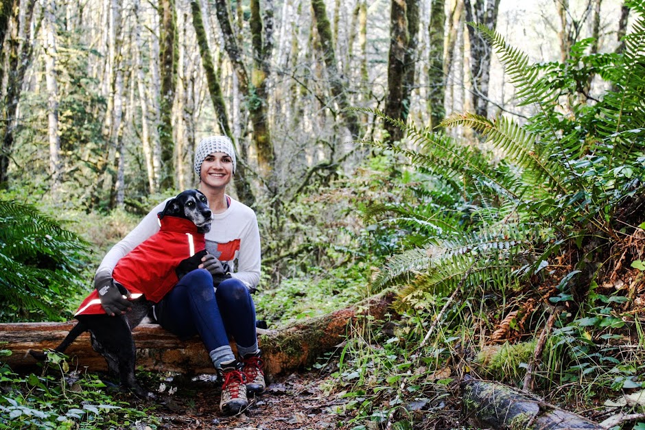
The dogs did great on the hike itself, there were a few spots with steep drop-offs, as the trail climbed up the Clackamas Canyon walls. Overall, it was dog friendly, and we only saw a few other people hiking. We did in fact see several kayakers and rafters on the river, as its almost always visible from the trail (it would be very difficult to get lost on this hike).  

For campers, there are several great camp sites along the trail that access the river, with existing fire pits. If you're looking for seclusion, this may not be your favorite spot, as the highway is just on the other side of the river, but the actual campsites sit back from the river enough for some privacy.

Watch out for poison oak on the switchbacks, a lot of hiker blogs will mention it has been a problem in the past few years.


The one and only Pup Creek Falls.


Pretty Roots. They seemed so alive.
I found a girl dancer on this hike (the male half was found months earlier earlier on the Bagby Hot Springs Trail). 

The ladies cleaning up whatever was for dinner the night before.